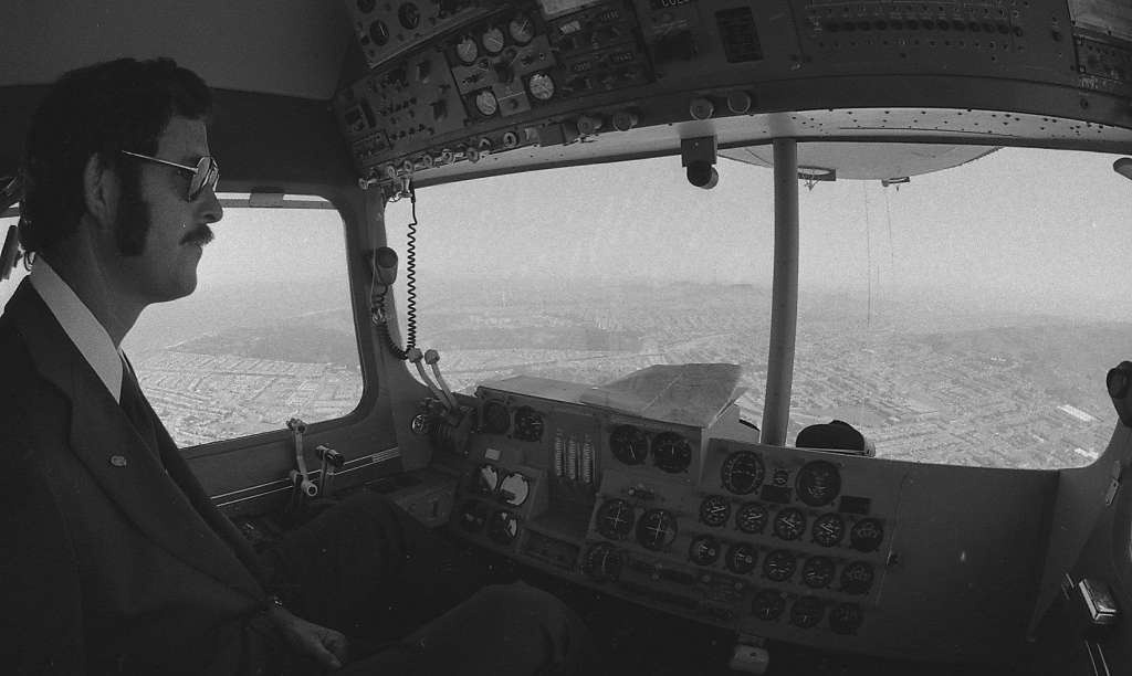
Capt. John Crayton piloted the blimp as it cruised over San Francisco and the central Bay Area with Chronicle photographer Terry Schmitt on board, June 12, 1975. Photo: Terry Schmitt, The Chronicle
The Chronicle shared a nice collection of shots today that were taken from the cockpit of the Goodyear Blimp in June 1975.
In June 1975 one of The Chronicle’s photographers captured stunning sights: views of the city and surrounding areas from the cockpit of the Goodyear Blimp. The images, squirreled away in a drawer of negatives in the paper’s basement archive for years, were shot by photographer Terry Schmitt and include aerial photos of the Golden Gate Bridge, Transamerica Pyramid, Candlestick Park and the city’s waterfront.
Here are a few of our neighborhood – little boxes! 🙂 See the full gallery here
Sarah B.
The Outer Richmond, between Golden Gate Park and the Presidio. Photo: Terry Schmitt, The Chronicle
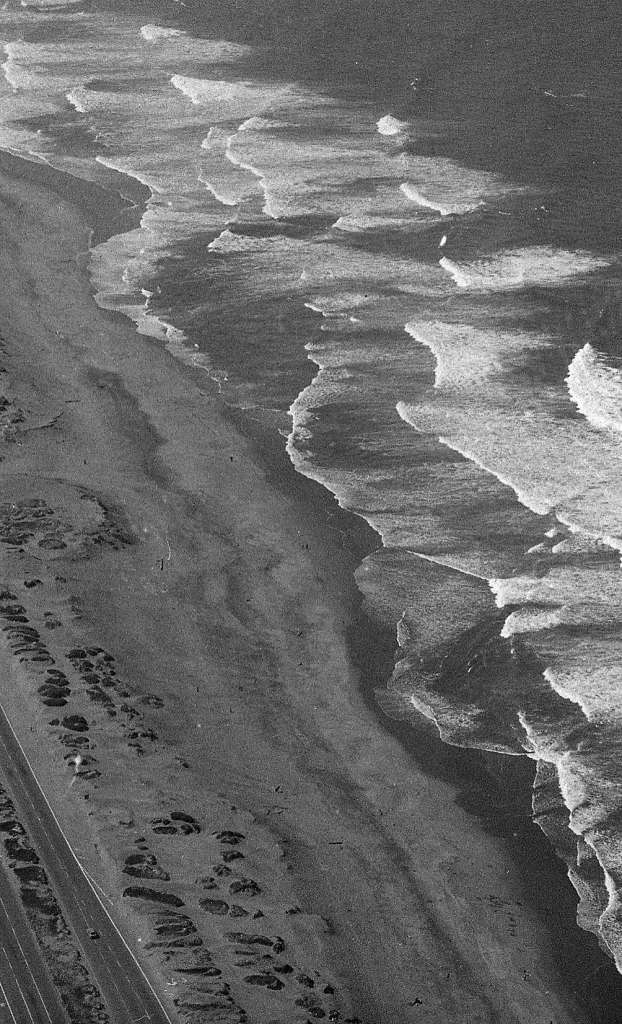
The waves at Ocean Beach. Photo: Terry Schmitt, The Chronicle
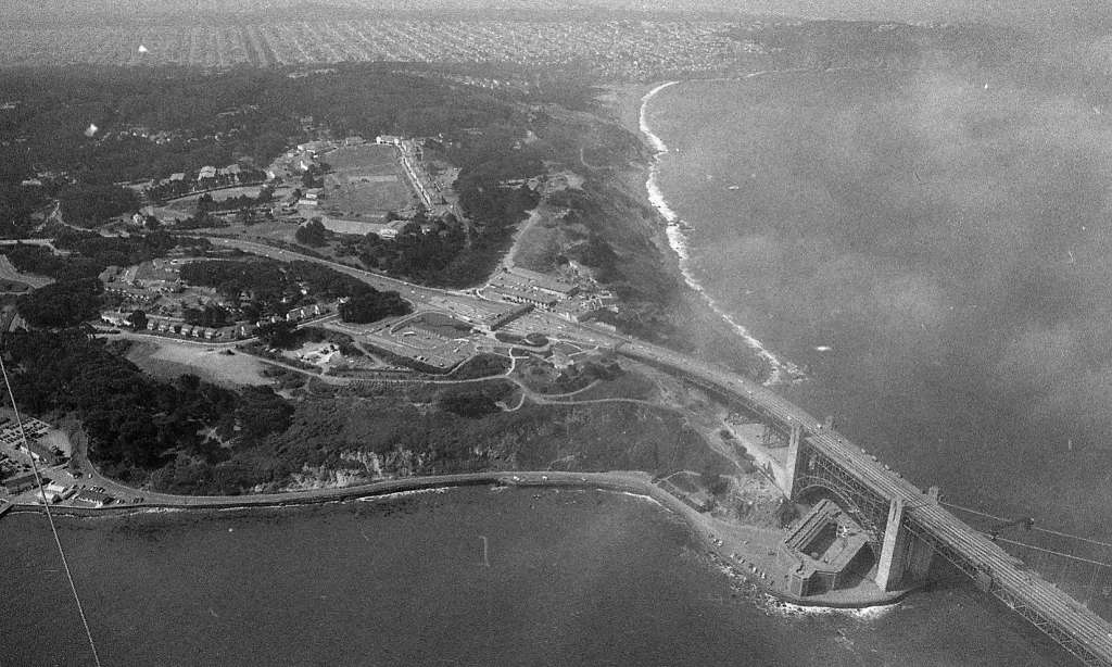
Looking south as the fog rolls in above the Golden Gate Bridge. Photo: Terry Schmitt, The Chronicle
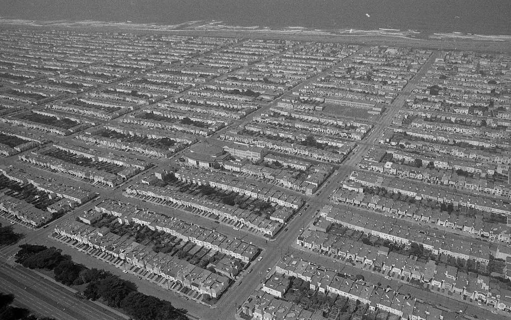
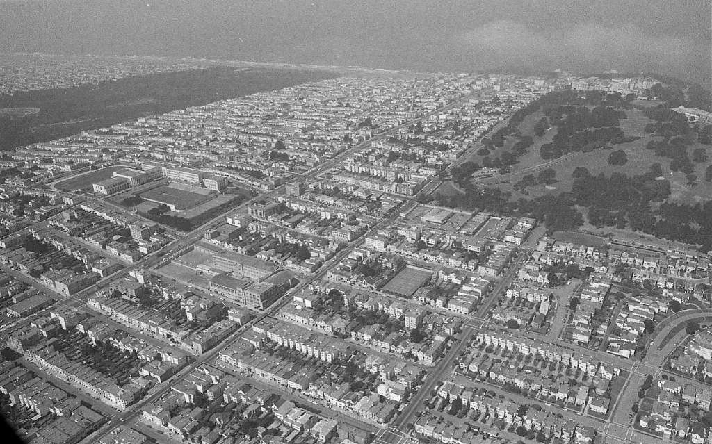
Looking west over the Outer Richmond and Sunset District. Photo: Terry Schmitt, The Chronicle
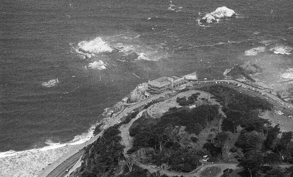
The Cliff House and Seal Rock stand below Sutro Park. Photo: Terry Schmitt, The Chronicle
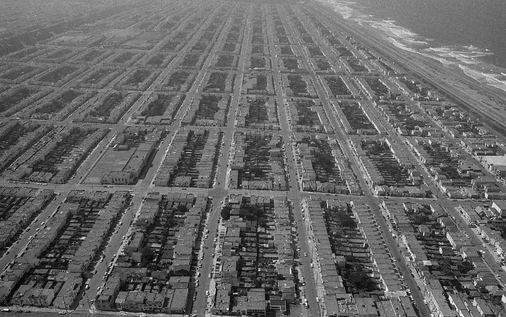
Looking south over the Outer Richmond and Sunset District. Photo: Terry Schmitt, The Chronicle

Ocean Beach from the air. Photo: Terry Schmitt, The Chronicle
Neat! That first picture actually shows Lincoln Park in the near right, not the Presidio. That’s the end of Lake curving over to the right into Sea Cliff.
GREAT PIX!
A couple of nits about the captions, tho. The ones labeled “Outer Richmond and Sunset District” actually only show the Sunset. And, as MattyJ correctly states, that’s Lincoln Park, not the Presidio.
All very astute corrections to the captions! Those are the actual captions from the Chronicle story so I’ll try to set them straight as well 🙂