
[El Camino del Mar at 24th Ave] Trestle across Lobos Creek in Presidio. Aug 13, 1917. Courtesy of OpenSFHistory.org.
Have you been to OpenSFHistory.org? It’s a website run by the Western Neighborhoods Project that is slowly posting digitized versions of a large, historic collection of San Francisco photos donated by an anonymous resident.
You can search by name or topic, and even use a map to look up photos by location.
Every month or so, the hard-working team at opensfhistory.org uploads the latest scans to the site. Here are a few of the Richmond District highlights showig some interesting views from the Lake Street and Presidio areas. Enjoy!
Sarah B.

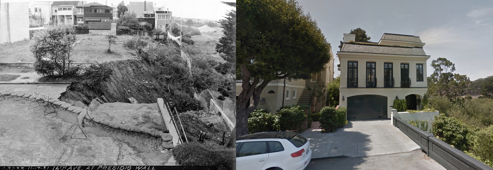
16th Avenue at Presidio Wall. Nov 17, 1931. Courtesy of OpenSFHistory.org
1917 and today at the start of 16th Avenue by the Presidio wall

16th at Presidio Wall. Nov 17, 1931. Courtesy of OpenSFHistory.org

16th Avenue & Lake. Nov 10, 1932. Dr. Loutzenheiser’s House. Looking northeast towards Public Health Service hospital. Courtesy of OpenSFHistory.org
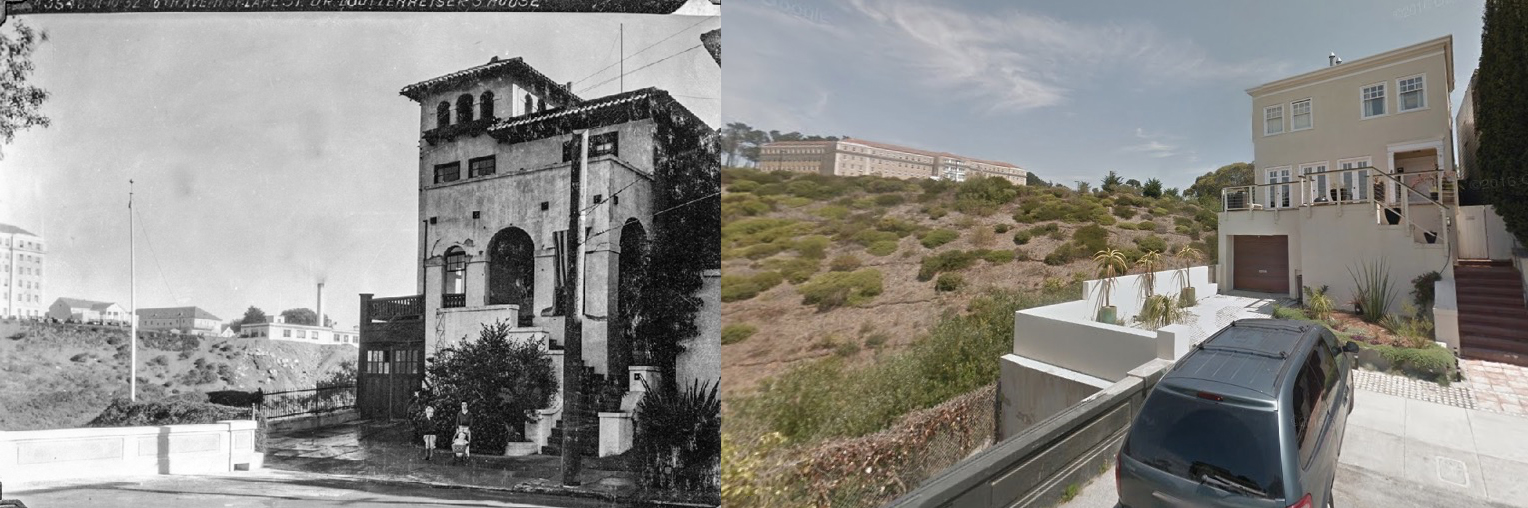
1932 vs. today. You can see the retaining wall that was built after the slide; it’s still in place today.
Speaking of historical nearby neighborhoods, this is a pretty interesting article:
http://www.sfchronicle.com/bayarea/matier-ross/article/Rich-SF-residents-get-a-shock-Someone-bought-11738236.php
Geary west, from 37th ave.
http://opensfhistory.org/Display/wnp36.01479.jpg
Love this stuff, thanks!