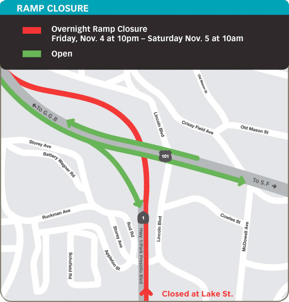
Overnight closure of southbound Highway 1 exit from GGB, Friday
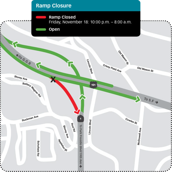
This Friday night from 10pm until 8am on Saturday morning, the ramp from southbound Highway 101/Doyle Drive to southbound Highway 1/Park Presidio Boulevard will be closed. View the full advisory That means if you’re returning from Marin during the closure,… Continue Reading