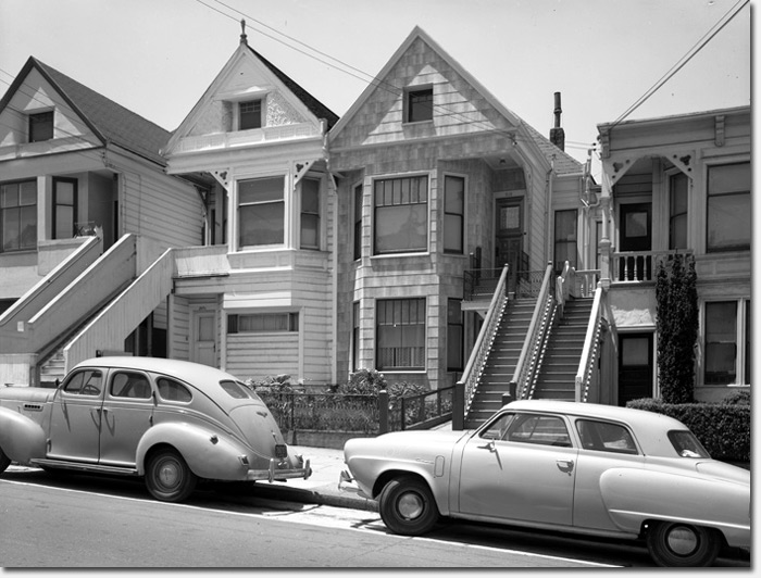
215 6th Avenue, 1951. Courtesy of Western Neighborhoods Project
The history-minded folks at the Western Neighborhoods Project recently acquired a photo collection from a local historian; he had saved them from being discarded in the early 1980s.
The photos are from the San Francisco Assessor’s Office and were all taken in 1951. WNP explains:
The Assessor’s Office periodically photographed buildings around the city for property tax purposes. The photos are documentary in nature and were taken without regard to the scenes on the street. As a result, in addition to showing the buildings, other things were recorded too, such as parked cars and people going about their daily lives. We think these make for an excellent view into what life was like on our streets over 60 years ago.
The WNP team has created a new website just for the photo collection at 1951.outsidelands.org, that includes a handy Google Map that allows you to see where the photos are across the city.
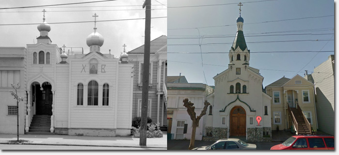
There are many in the Richmond District, a few of which we’ve included here. As is the case with San Francisco, some things have changed a lot, while others not so much. Check out the map – you may see a slice of life from your very own block in 1951.
Thanks to the Western Neighborhoods Project for digitizing and sharing the 4×5 inch negatives, which will also be donated to the San Francisco History Center at the San Francisco Public Library, adding to its large collection of Assessor’s negatives.
Into local history? The WNP is a non-profit and always welcomes donations and new members (they have an awesome quarterly newsletter).
Sarah B.
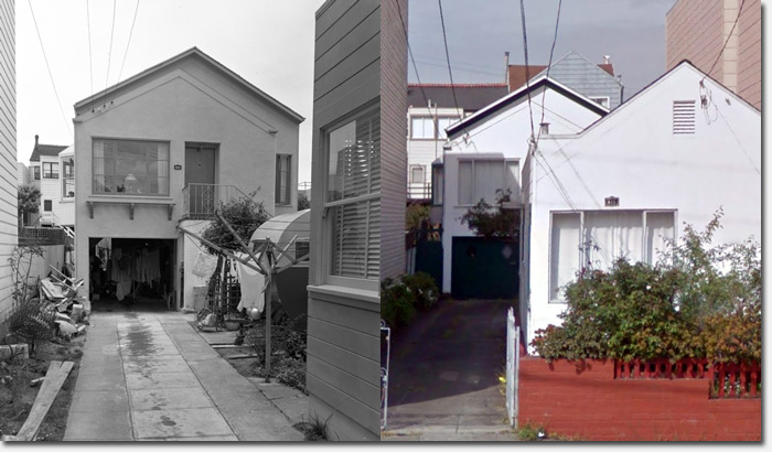
522 35th Avenue, 1951. Courtesy of Western Neighborhoods Project
594 18th Avenue, 1951. Courtesy of Western Neighborhoods Project
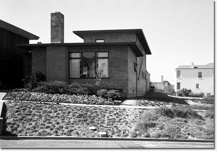
5717 California, 1951. Courtesy of Western Neighborhoods Project
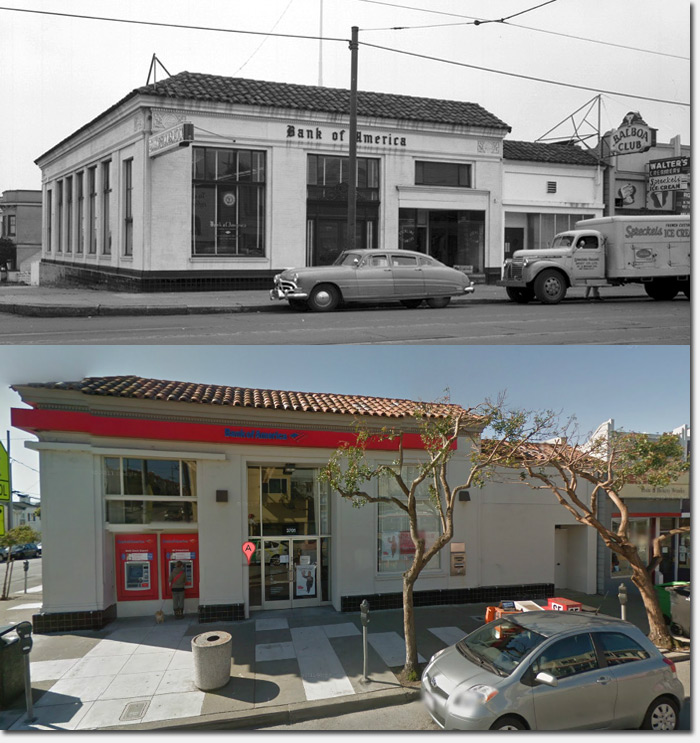
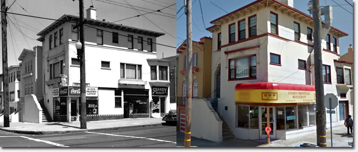
Still a BofA! 3701 Balboa, 1951. Courtesy of Western Neighborhoods Project
673 26th Avenue, 1951. Courtesy of Western Neighborhoods Project
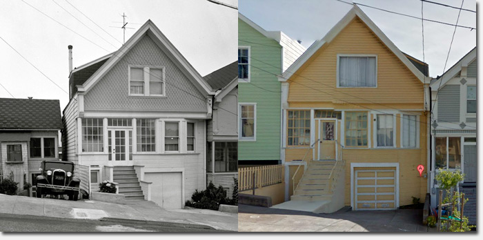
35 27th Avenue, 1951. Courtesy of Western Neighborhoods Project
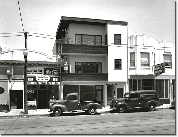
120 Clement Street, 1951. Courtesy of Western Neighborhoods Project
I’d like to know more about the “Balboa Club” & “Walter’s Creamery” next to BofA, looks to be getting a fresh delivery of “Spreckels Ice Cream”. Cool!
@Paul – try searching on http://outsidelands.org – they have a lot of great info.
Sarah B.
Another pretty cool “then & now” is the photo of 120 clement: http://1951.outsidelands.org/image.php?img=/images/1951/west/c1095_120_Clement_Cozy_Cove_1951.jpg
The Cozy Cove is now Chapeau!; the Clement French Laundry is the Plough and Stars.
https://maps.google.com/maps?ie=UTF-8&layer=c&z=17&iwloc=A&sll=37.783240,-122.460596&cbp=13,10.3,0,0,0&cbll=37.783136,-122.460620&q=120+clement+sf&ei=8x2qUrjDE4jvoASPyoCQBA&ved=0CC0QxB0wAA
Very very ‘plus ça change, plus ça même chose’ if you ask me.
These photos are great! So interesting to see what the neighborhood was like.
Comparisons for the first and last photos:
https://maps.google.com/maps?q=215+6th+Avenue,+San+Francisco,+CA&hl=en&ll=37.784232,-122.464525&spn=0.008818,0.016512&sll=37.784219,-122.464842&layer=c&cbp=13,258.77,,0,1.69&cbll=37.78432,-122.464533&hnear=215+6th+Ave,+San+Francisco,+California+94118&t=h&z=17&panoid=zxmn1svgc0_Sib37ED5qYg
This row is very familiar to me, and it has never been the most beautiful. Looked a fair bit better before, but that house on the right had already lost its attic in 1951. I guess parking is considered more valuable than front gardens. The house in the middle left is curious– not only did it lose its attic, but the front facade was squared off as well. Still seems to be the same structure, though.
https://maps.google.com/maps?q=35+27th+Avenue,+1951&ll=37.788454,-122.488031&spn=0.008818,0.016512&sll=37.788280,-122.488315&layer=c&cbp=13,253.54,,0,3.44&cbll=37.788362,-122.487988&hnear=35+27th+Ave,+San+Francisco,+California+94121&t=h&z=17&panoid=gc5MPwC2X99eiM6kV4VGLw
There certainly was a lot less junk permanently planted on sidewalks by City Hall. Note the absence of signs and public trash cans. A lot less cars even though city population is relatively similar when excluding surrounding counties explosion of drivethroughs and incoming commuters.
We love these pictures, hopefully other people will too!
One of the things we notice in the pictures is that there are a lot of newly renovated, stucco’ed, asbestos-sided buildings. Recent work that most likely prompted a photograph by the Assessor. Some of them are quite sad, but a sign of the times.
One of my favorites is 1830 Lyon a newly transite covered corner building in 1951: http://1951.outsidelands.org/image.php?img=/images/1951/east/c702_1830_Lyon_1951.jpg
and a beautiful restored Victorian in 2013: http://goo.gl/maps/1yfnM
The BofA is cool – especially since it’s still the same bank! And the contrast of the 1951 car to the 2013 hybrid thing is fun to see!
Oh man, they have the house directly across from my house, but not my house 🙁 c’est la vie. cool to see what my old stretch of balboa looked like, so many more businesses then than now.